
Glencoe Stormwater Master Plan
The Village of Glencoe has invested in stormwater improvements for more than three decades to reduce local and recurring flooding. The Stormwater Master Plan builds on those efforts by identifying remaining challenges and potential future improvements.
Why a Master Plan?
The Village continues to experience flooding due to factors including aging infrastructure and more intense rainfall events. The Stormwater Master Plan evaluates these challenges and identifies potential projects to help address remaining flooding issues.
What is a Master Plan?
This Stormwater Master Plan is a planning document intended to identify stormwater needs and develop potential projects for prioritization and budgeting purposes. Further design development will occur when the recommended projects proceed toward construction.
H&H Modeling
Understanding where and how flooding occurs in villages such as Glencoe is done using hydrologic and hydraulic (H&H) modeling. Hydrology models how much runoff occurs when it rains, and hydraulic models route the runoff through storm sewers and overland features such as ditches, ravines, and detention basins.
The modeling team used the state-of-the-art Infoworks ICM (Integrated Catchment Modeling) software for this Master Plan. ICM uses the Village’s GIS layer of storm sewers and an overland flow model derived from high-resolution LiDAR elevation data to create a representation of flow in sewers and over the surface.
Design Rainfall
Design rainfalls apply statistical distributions to rainfall gage measurements to estimate intensities for given recurrence intervals (i.e. 1%-annual exceedance (100-year), 10% annual-exceedance (10-year)) used for design purposes. Illinois design rainfalls are obtained from the Illinois State Water Survey (ISWS) Bulletin 75 that was published in 2020.
Bulletin 75 aggregated rainfall records from stations across Illinois and split the state into 10 regions. Design rainfalls for Northeast Illinois, where Glencoe is located, were calculated based on 22 stations in the Chicagoland area, with an adjustment factor applied to reflect recent increases in storm intensities.
The critical duration design rainfalls for this study are:
- 10-year, 1-hour: 2.42 inches in 1 hour
- 100-year, 1-hour: 4.03 inches in 1 hour
Inundation Maps
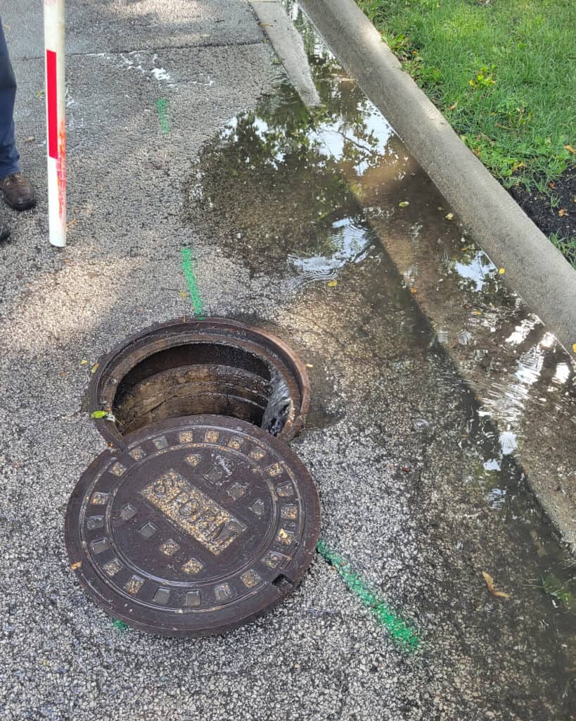
The ICM model routed runoff hydrographs (flow versus time) to the storm sewer network, depressions, and ravines. When storm sewers reach their capacity, the model routes the excess water to the surface where it then flows based on the topography.
The model provides peak water surface elevations for each design storm event. The 100-year, 1-hour storm was determined to be the storm that produces peak flooding consistently across the Village.
Inundation maps showing all flooding 6-inches for the 100-year, 1-hour event were produced for the Existing Conditions.
Design Criteria
The Stormwater Master Plan is developed by applying consistent criteria across the Village so all areas are analyzed on an even playing field. The project team and Village staff reviewed potential design criteria and selected the following:
- No structure impacts for 6-inches of flooding during the 100-year, 1-hour storm
- No street ponding greater than 6-inches during the 100-year, 1-hour storm
Priority Area Determination
Geographical Information System (GIS) software was used to overlay Village buildings and roads with the modeled inundation layer and identify all impacted buildings and street locations with greater than 6-inches of ponding.
Water resources issues are often interconnected within a common watershed, so the critical locations were grouped together in subwatersheds to develop comprehensive solutions. The identified critical locations were cross-referenced with Village flooding records and responses from the resident flooding survey to ground-truth the model results.
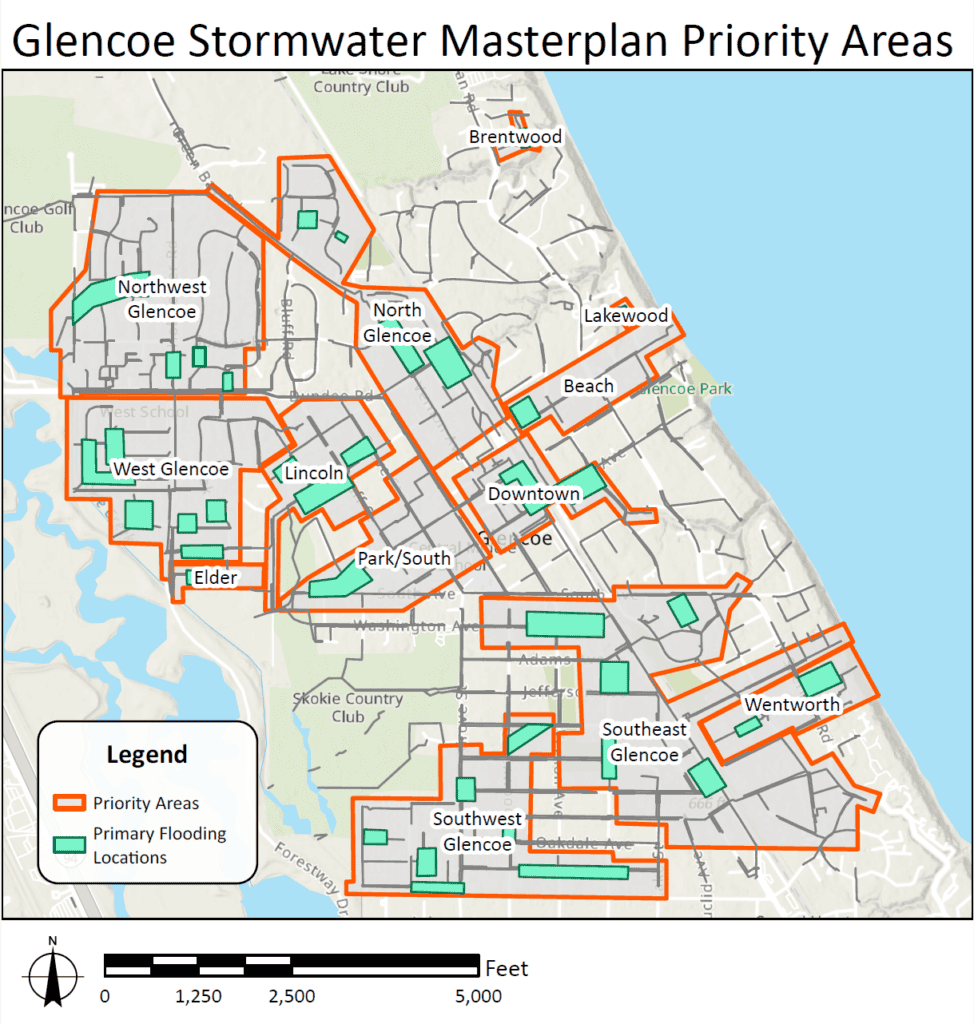
Click photo to enlarge.
Alternative Development
For each priority area, the model results and visualization tools were used to understand how and why flooding is occurring. A suite of potential solutions were considered for each location, including increasing the diameter of existing sewers, adding new sewers, constructing surface detention, and installing underground detention vaults.
Green infrastructure such as rain gardens and permeable pavement usually do not provide significant benefits for the intense design rainfall events, but it is considered as an option to enhance the benefits of the proposed solutions.
Multiple alternatives were considered for each priority area and ones that were deemed feasible were moved forward in the process. Some priority areas have several alternatives presented in the final Plan, while others only have one that provides an effective solution to the modeled flooding.
To assist with the planning process, the following were developed for each of the alternatives:
- Project concept drawings that included proposed sewer sizes and routes, detention volumes, and key features such as ravine outfall improvements and underground railroad crossings
- Cost estimates based on recent awarded projects in the Chicagoland area
- Identification of construction challenges, permits required, and coordination with agencies such as the Forest Preserve District of Cook County
Project Ranking
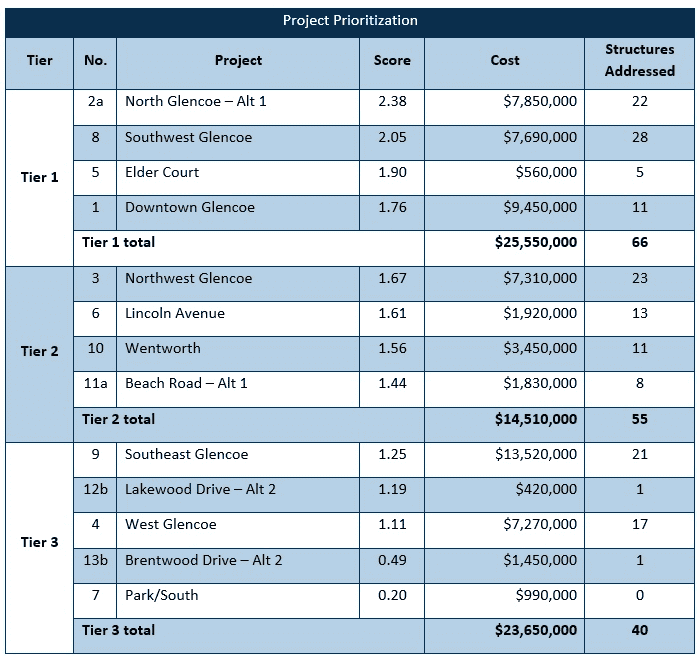
A Stormwater Masterplan assesses alternative projects using a consistent set of criteria across the entire Village. The prioritization is not a final guide for how the Village will invest in stormwater projects, but it does provide a plan to inform future budgeting decisions.
A weighted criteria approach was selected for the Glencoe Stormwater Master Plan:
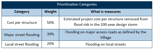
Projects were divided into three tiers based on the weighted scores. Tiers 1 and 2 represent the portion of the program where the greatest reduction in flood risk is achieved per dollar invested. Tier 3 projects remain justified where flooding is severe or where they can be coordinated with other infrastructure improvements, but they should not displace higher-tier projects competing for the same funding.
North Glencoe
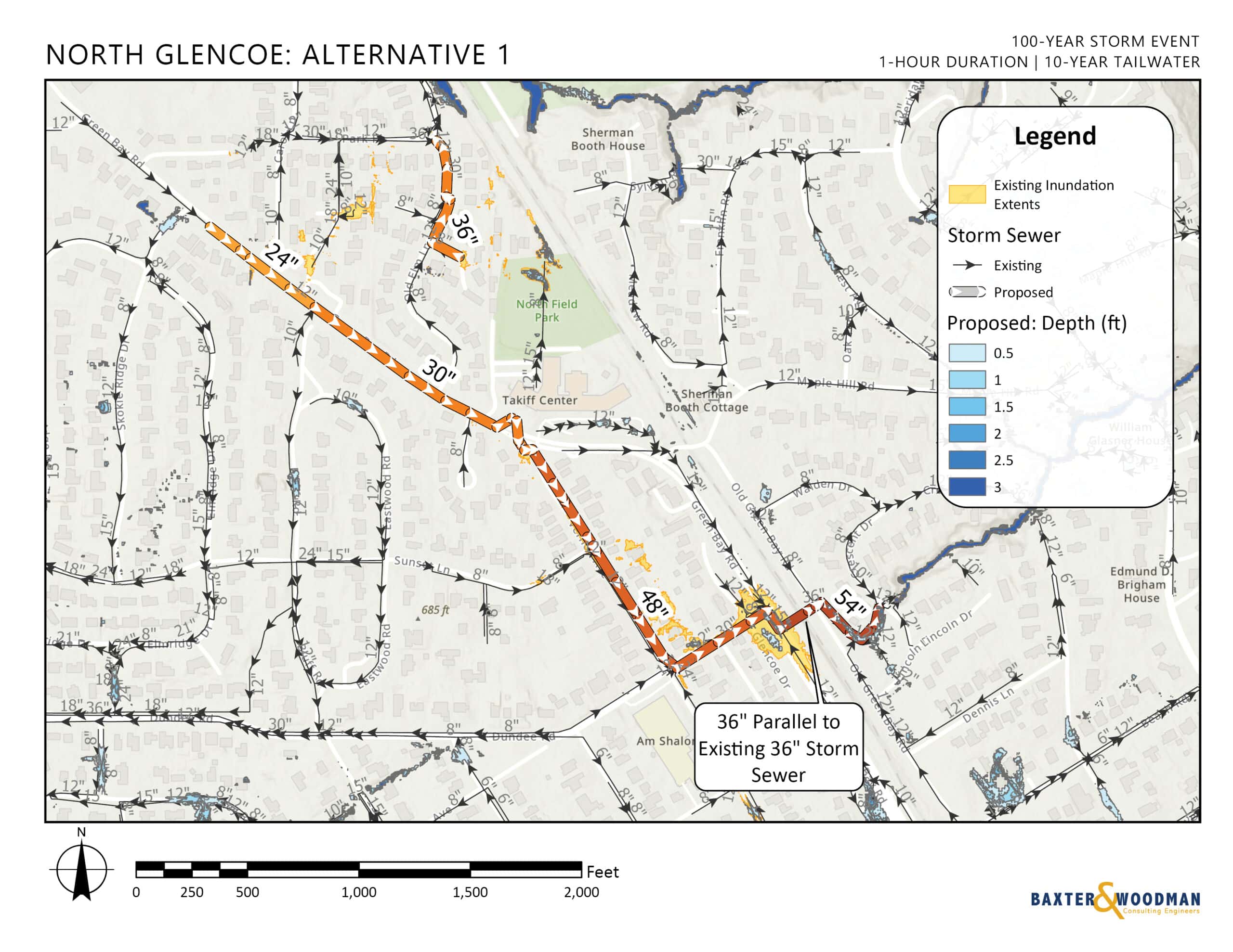
The North Glencoe priority area is a linear watershed that runs from west to east along Green Bay Road from the neighborhood that includes Linda Lane, Park Place, and Terrace Couty to the ravine outfall at Crescent Drive. Flooding in the North Glencoe priority area currently occurs at Linda Lane / Park Place and at the intersection of Dundee and Green Bay Roads.
Two alternatives were developed for the North Glencoe priority area. Both alternatives include larger storm sewers along Green Bay Road, a new pipe underneath the railroad tracks near the Dundee / Green Bay intersection, and an upsizing outfall to the ravine at Crescent Road. Alternative 2 included underground detention east of the railroad tracks under the parking stalls along Old Green Bay Road. The goal of the underground storage is to reduce peak discharges to the ravine.
Alternative 1 was selected as the recommended option for the North Glencoe priority area.
Structures Benefitted: 22
Estimated Cost (2026): $7,850,000
Southwest Glencoe
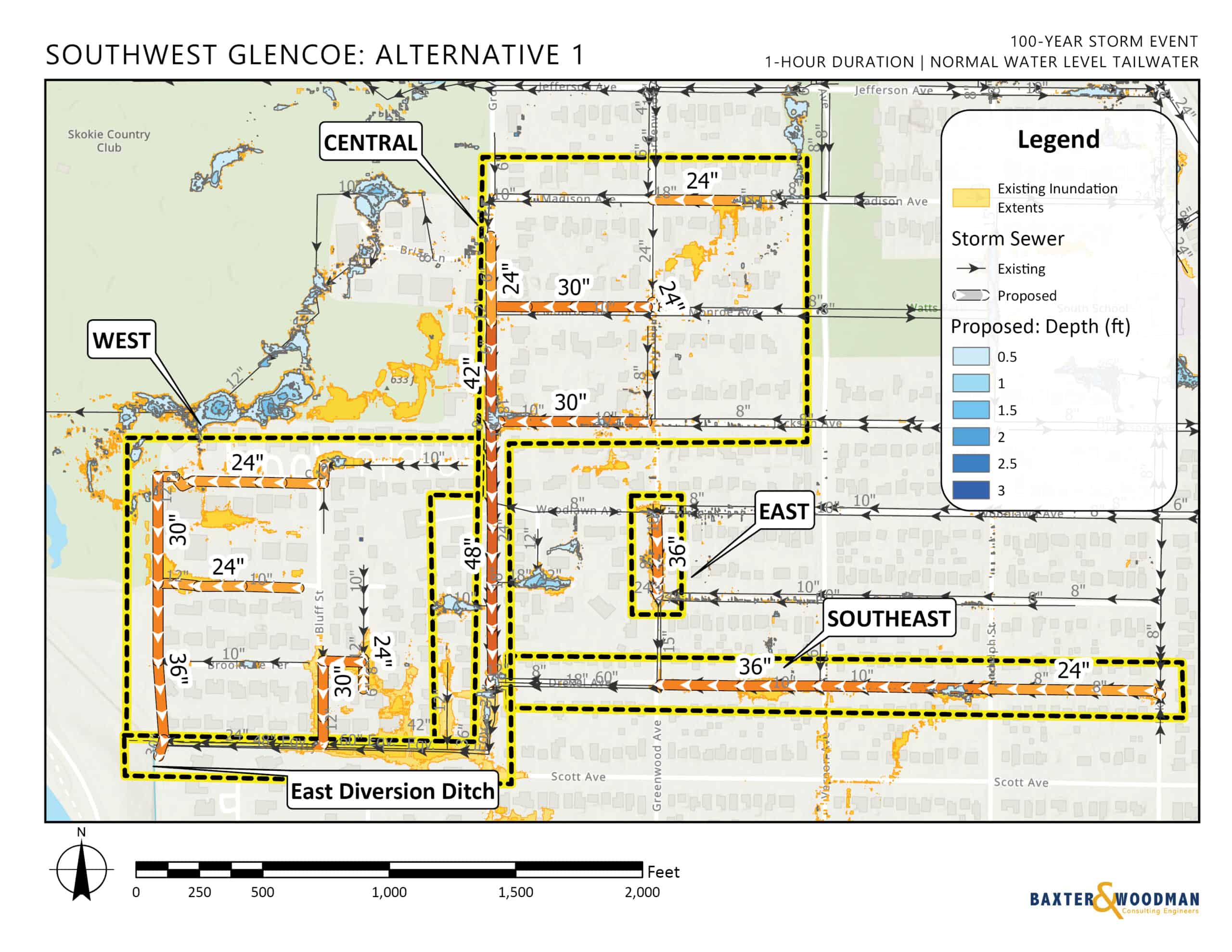
The Southwest Glencoe priority area has several locations that show ponding that impacts residences. The priority area was divided into several subwatersheds that will allow the Village to construct improvements using a phased approach.
Water levels on the East Diversion Ditch affect ponding in the priority area, with sewers discharging to the Ditch at three locations.
The priority area is low-lying, near the outfall, and in a heavily residential area, which makes installation of underground storage challenging and expensive. Several conveyance options with larger storm sewers were considered for the focus area. The recommended improvements help capture water from surface ponding and provide an outlet to the East Diversion Ditch, removing excess water that affects residences and streets.
Structures Benefitted: 28
Estimated Cost (2026): $7,690,000
Elder Court
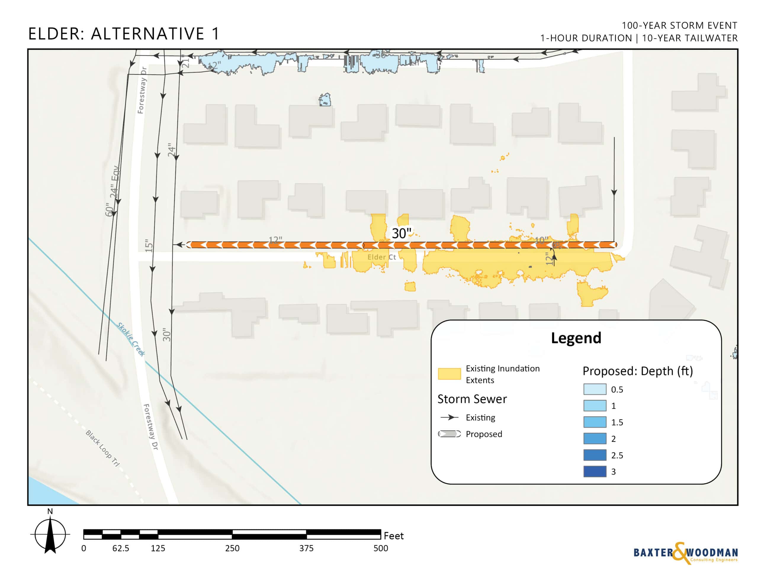
Elder Court is located in west Glencoe, just east of Forestway Drive. The street is currently drained by a sewer that is 10 then 12-inches in diameter that discharges to a 30-inch sewer in the Forestway right-of-way. There is a low spot at the turn where Elder becomes Oak Drive that is not drained by the 10-inch sewer during the design storm.
The 30-inch sewer on Forestway Drive has additional capacity, and thus the recommended project is to increase the size of the storm sewer to 30-inches along Elder Court.
Structures Benefitted: 5
Estimated Cost (2026): $560,000
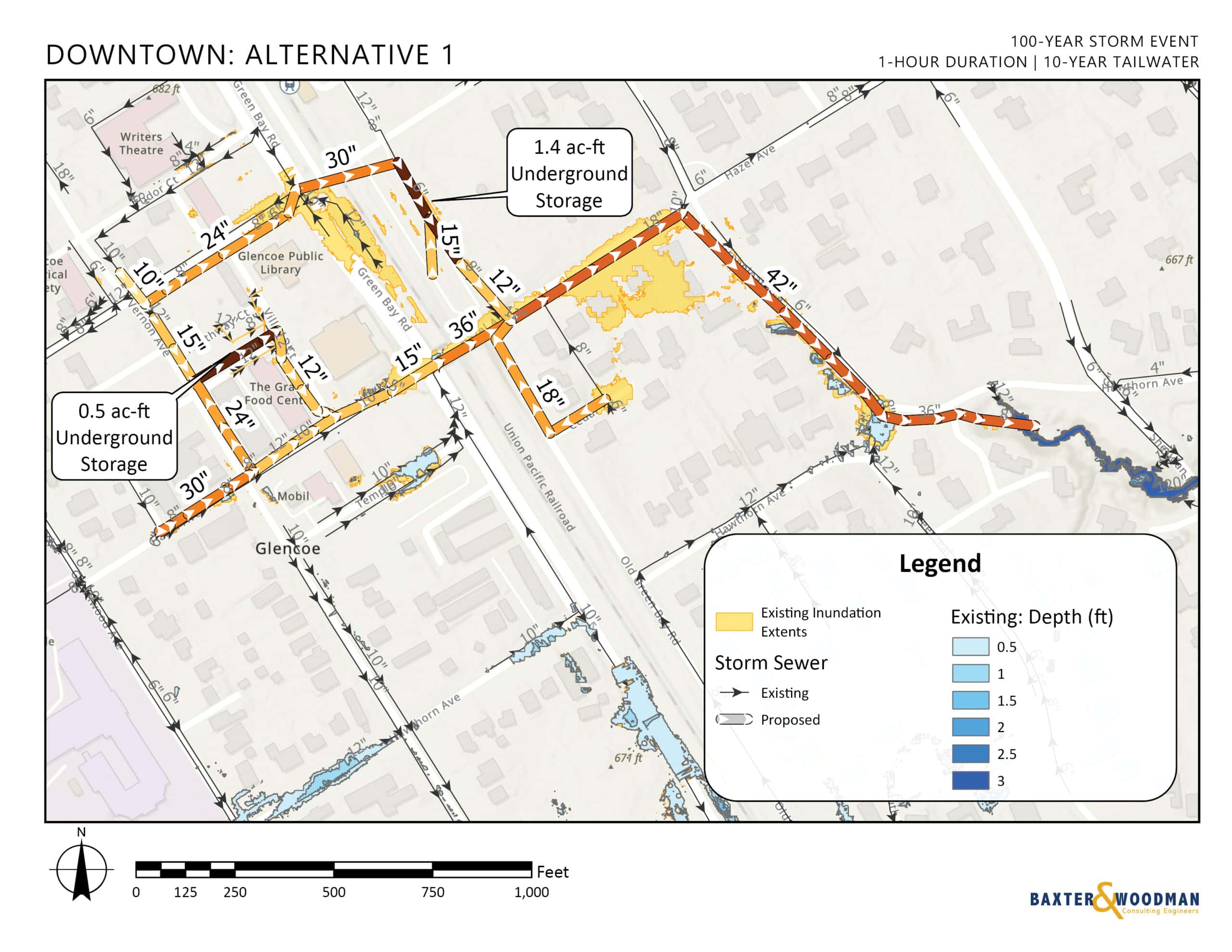
Downtown Glencoe
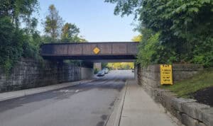
Flooding on Hazel Avenue at the Green Bay Road underpass is a known issue for the Village. Short, intense storms frequently overwhelm the capacity of the storm sewer and cause flooding that blocks the road and impacts adjacent buildings. Flooding in the area was also observed in parking lot at the corner of Park Avenue and Green Bay Road.
The downtown area receives surface flow from the west and flow to the ravine outfall is restricted at the underpass. The proposed alternative includes a mix of underground storage and increased sewer capacity from the underpass to the ravine outfall at Hawthorn Avenue.
Structures Benefitted: 11
Estimated Cost (2026): $9,450,000
Stormwater management in Glencoe includes more than just investment in stormwater infrastructure. The Stormwater Master Plan provided a comprehensive assessment that also included an assessment of the Village’s ravines, stormwater ordinance, operations and maintenance, and the potential for establishment of a stormwater utility assessment.
Ravines
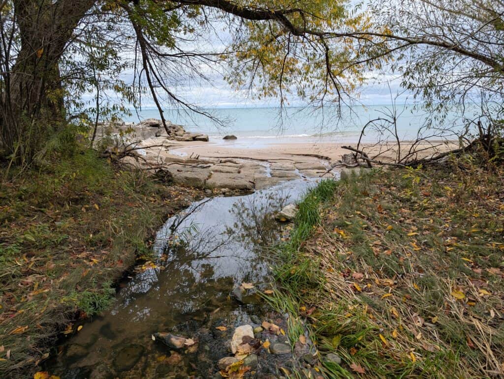
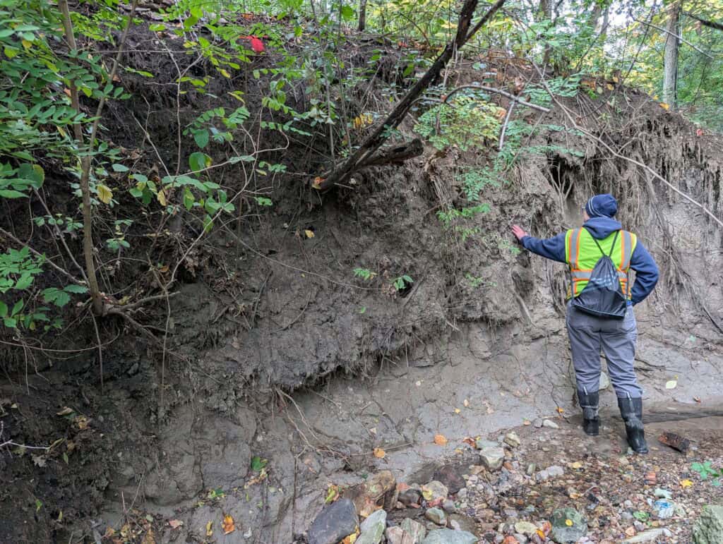
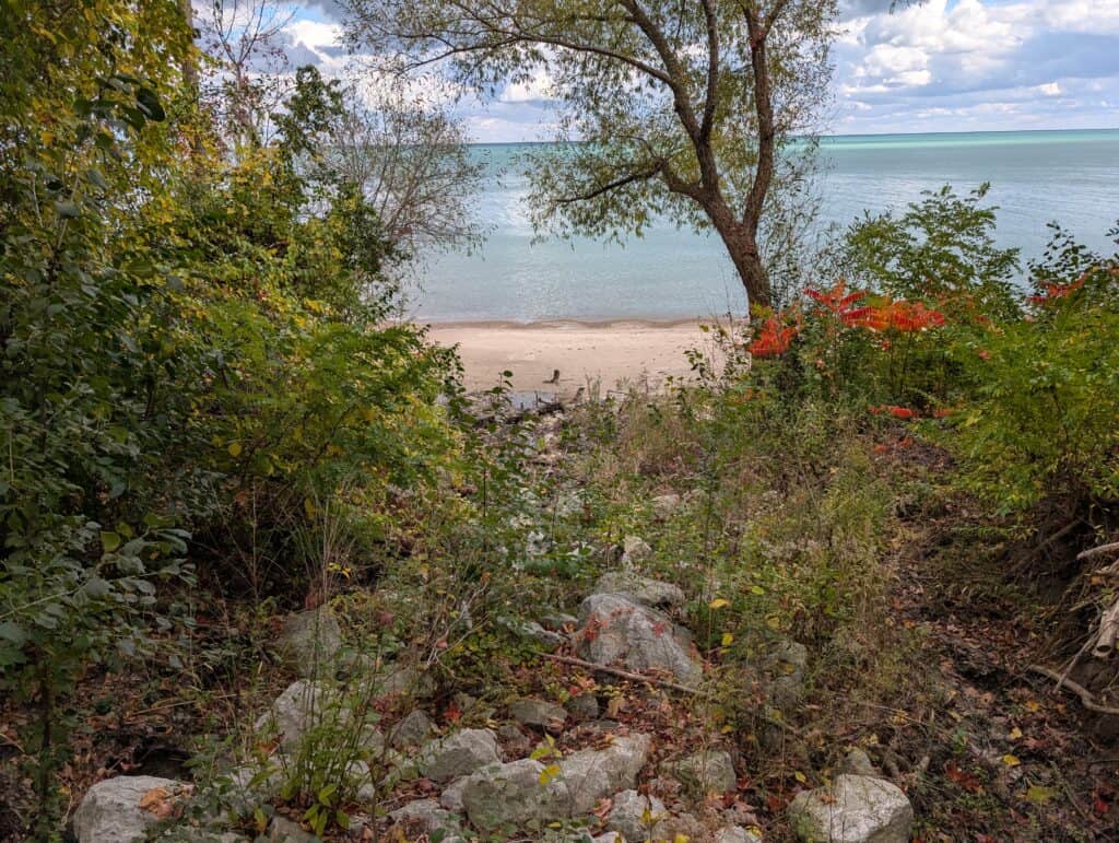
Glencoe has a unique setting on the shores of Lake Michigan with steep ravines that receive runoff from runoff and storm sewers that ultimately discharge to the lake. Stormwater discharges can cause downcutting and erosion that exposes storm sewers and washes out previous projects. Ravine erosion is exacerbated by factors such as urbanization and the observed increases in intense rainfall events.
The Stormwater Master Plan assessed the current conditions of the Village’s ravines and identified stabilization and restoration measures that can be taken to restore a healthy ravine system and protect infrastructure. The assessment provided a general overview of the health of the Village’s ravines and focused on unique conditions where present.
The final ravine assessment report created a Ravine Restoration Toolbox the Village for use in future ravine management.
Ordinance Review
The Village Code addresses stormwater management for developments in Chapter 9 Article 12 (Stormwater Runoff Restrictions), Article 13 (Land Grades), Article 14 (Flood Control Regulations), and Article 15 (Steep Slope Restrictions). Article 12 specifies detention requirements for residential developments and does not include stormwater management requirements for commercial or business sites.
The project team performed a comprehensive review of Glencoe’s current practices and compared requirements to neighboring communities and MWRD. The review included current Village stormwater management rules, comparisons with neighboring North Shore communities and MWRD, floodplain management, single-family detention, and steep slope and ravine requirements.
A comprehensive report was provided to Village staff summarizing findings. Some findings and recommendations include:
- The Village of Glencoe should create and codify an Engineering Standards Manual
- The Village’s single-family detention requirement is an effective policy for managing site runoff
- The Village’s requirements for single-family detention are consistent with other North Shore communities, but the Village’s allowable release rate is higher
- The Village does not currently have a requirement for detention on non-residential sites, which is inconsistent with MWRD rules
Stormwater Utility Assessment
This Stormwater Master Plan recommends about $60-70 million in projects to address the Village of Glencoe’s stormwater issues, which will need funding for design, permitting, and construction. The Village will pursue grant funding through agencies such as MWRD for eligible projects, but funding from the Village will still be required for many of the recommended projects.
Many municipalities have a dedicated source of funding called a stormwater utility to address at least some of these expenses. Glencoe can establish one with a Stormwater Utility Ordinance. The ordinance would allow the Village to set rates and requirements based on the anticipated expenditures versus what each property is contributing to the quantity of stormwater, typically based on impervious area and/or land use.
An example ordinance from a nearby community describes how charges would be established, “The actual charges to be imposed and any future changes in those charges for each property classification shall be made by resolution and set forth in the Fee Schedule adopted by the Village Board. All rates established pursuant to this chapter shall be fair and reasonable. The Fee Schedule and the classification of each property shall be maintained and on file in the office of the Village Clerk.
Adopting a village ordinance would allow for adjustments to rates, as needed, with approval from the Village Board based on the anticipated stormwater expenditures to be covered by the stormwater utility following the methods adopted in the ordinance. Funds raised by the Stormwater Utility would be used for construction and maintenance of the recommended sewer and detention projects, and it could also be leveraged to supplement the ravine improvements that are also recommended in this Stormwater Master Plan.